Ads not shown when logged in
-
Automated Tracker

 Paul Bailey's Beer Blog - An autumnal walk along the North Downs Way - Part Two
Visit the Paul Bailey's Beer Blog site
The second, and final day of my North Downs Way walk was, if anything, harder than the first. This was despite it being just over half the distance, in terms of actual miles walked. Two steep ascents, and the same number of equally precipitous descents didn’t help (what goes up, must come down), but neither did the fact that for much of the journey, I was walking through woodland. Being in what is effectively an enclosed environment, means it becomes difficult to judge distance travelled or, indeed, how much further there is to go. Basically, one loses one’s sense of perspective! Getting lost a couple of times on the initial part of the journey, didn’t help much either, but all in all it was still an enjoyable day’s walking; even if it was rather different from the previous day. That, of course, is the beauty of the NDW, as the scenery and, quite often the terrain, are so varied.
I set off in high spirits, after a good night’s sleep and a hearty breakfast following my overnight stop at the Black Horse, Thurnham. Straight away, I was forced to gain height, in order to access the NDW, following the steeply climbing road up from the pub towards the remains of Thurnham Castle, high on the ridge overlooking the surrounding countryside. The trail skirts the mound on which the castle is constructed, but according to my guidebook, there is precious little left of this 13th Century fortification. I should, of course have been paying attention to the guidebook – even though it is written for those travelling in an easterly direction, because after skirting the top of the hill that is home to the White Horse Country Park, I found myself trapped behind a barbed wire fence at the apex of a field.
I could see where I wanted to be but was reluctant to retrace my footsteps in order to regain the path. Fortunately, I manage to squeeze through a gap between the top of the fence and the string of barbed wire, although I had to remove both my rucksack and my coat in order to do so. This was a similar occurrence to what I’d experienced the day before, the common factor being the ownership of this area of the North Downs, by the Hucking Estate, and its management by the Woodland Trust. A lack of signage on this section of the NDW, seems to be a common complaint, if the reports on TripAdvisor are anything to go by; the most appropriate one being “Be prepared to get very lost!” Shortly after my undignified scramble through the fence, I again found myself looking for the correct path. I was aiming for the village of Detling, and whilst I could see it below, and to my right, how to access the correct track seemed a complete mystery.
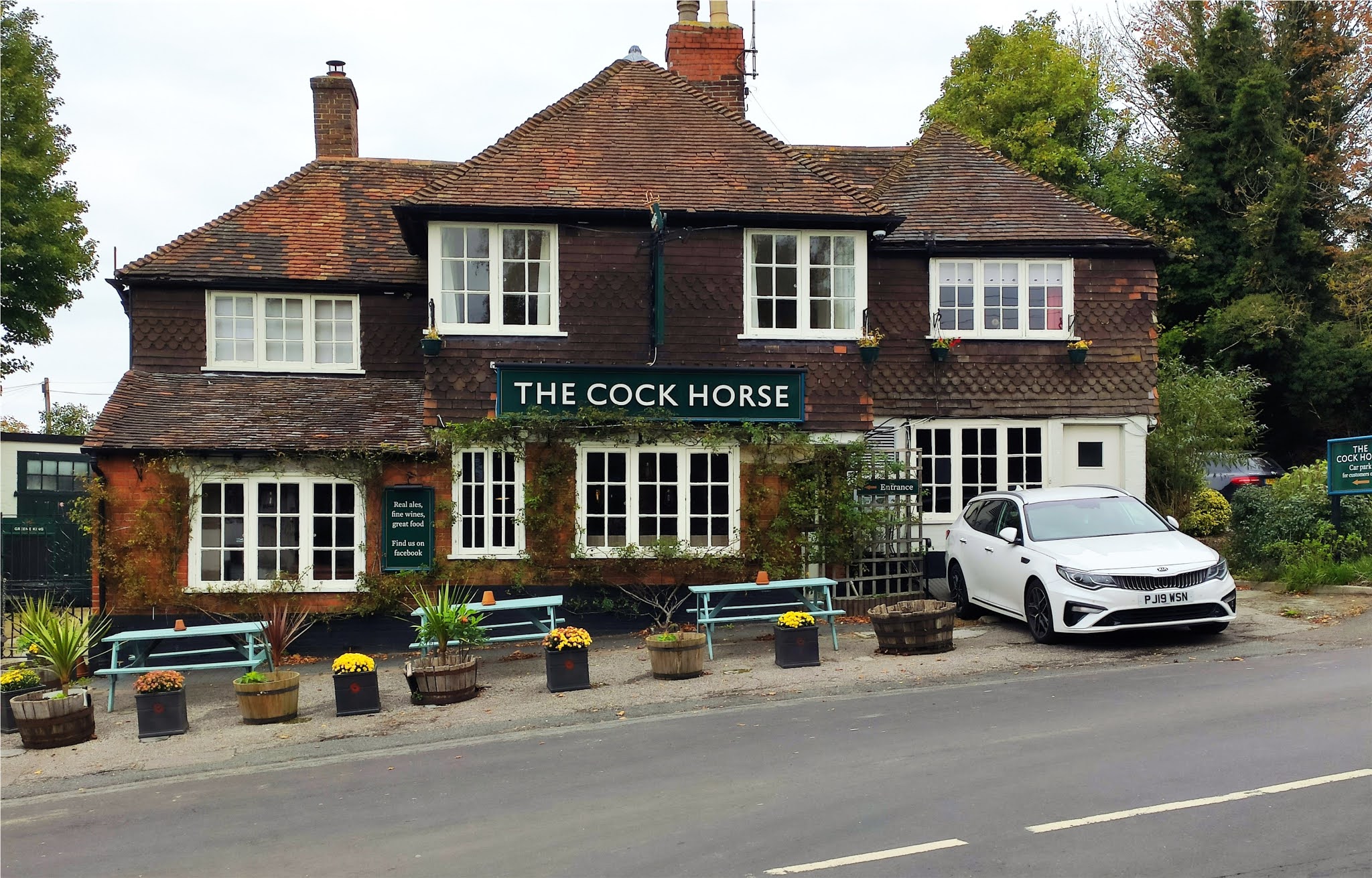
I sought advice from two women, out walking their dog, but they confessed they weren’t the best people to ask, as they too were lost. Fortunately, a knight in shining armour, in the form of another walker, came to our rescue. He put the two dog walkers on the right path, and then directed me to the steeply descending track that would take me down into Detling. He also warned of an even steeper ascent as the NDW makes its way out of the village, on the other side of the busy A249dual carriageway. My route into Detling was from the east, and as I approached the heart of the village, I could see the Cock Horse pub directly in front of me. I was too early for opening time and it was too early for a beer as well, so after skirting the pub I headed for the crossing that would take me over the A249.
The footbridge known as "Jade’s Crossing," is named after eight-year-old Jade Hobbs who, along with her grandmother, was killed in 2000whilst attempting to cross the A249. Despite this tragedy, and two earlier deaths, Kent County Council continued to resist calls for a protected crossing, until shamed into doing so by a fundraising campaign, led by local people. Walking across this footbridge with four lanes of traffic thundering underneath, it is difficult to imagine how the authorities could have been so callously short-sighted! The guide I’d spoken to earlier was right about the steep climb back up to the escarpment, as the track through the trees Hermitage Lane, seemed to go on forever, passing a substantial, but now disused chalk quarry. I had a slight chuckle over the spoof entry that appeared in a local CAMRA pub guide 40 years ago, in response to plans to reopen the former Detling Lime Works, which was sited in this very chalk pit. I was one of several people who went looking for the “Quarryman’s Arms,” an old pub that had “reopened, after standing empty for many years.” Local opposition to the quarry’s reopening must have been running strong, so I take my hat off to the two lads (both CAMRA members), who managed to hoodwink the editor by getting this fictitious entry, a place in the guide!
The NDW takes a sharp turn to the left at the top of this lane, and then follows the edge of a beech-wood for several miles. Boxley Woodmerges into Westfield Wood, and whilst this section was on level ground, until the very end, quite frankly it was boring. Okay, it was nice to be out of the wind, and good to be on the flat, but with very little in the way of landmarks to act as guidance, it was difficult to know exactly where one was.
At times, the trail veered off deeper into the woods, whilst at others it left the shelter of the trees for the edge of a muddy field. I took no photos, as there was very little to capture on camera, but whilst the walk was boring, there were times when it felt a little creepy – almost as if I was being followed! I wasn’t of course, although I was very nearly bowled over by a powerful female jogger who came bounding towards me, but returning to the subject of woodland walks, there is something slightly spooky, a sort of primeval fear that goes with walking alone, through a wood which never seems to end.
The wood did eventually end, but not before a lengthy, and at times quite steep descent through some dense and quite gloomy areas of woodland. In several sections there were steps cut into the slope, to make one’s descent easier, but even so I was mightily relieved to have brought my trusty walking stick along. Not only did it steady me during this tricky descent, it also stopped me tripping up over numerous, half-buried tree roots. A stick also gives added impetus on upward sections and helps one maintain a steady and rhythmic pace on level ground.
I emerged from the trees just past the White Horse Stone; a Neolithic megalith of some historic significance. I was feeling rather weary and footsore by this time and had already passed this large and unevenly shaped lump of stone, before I realised what it was. I certainly wasn’t persuaded to deviate the short distance from the trail for a closer inspection.
Instead I passed out of the woods and followed a path which led over the high-speed rail line, just before it disappears into a lengthy tunnel, beneath the mass of the looming Blue Bell Hill. After crossing the railway and then disappearing into the rather gloomy subway under the busy A229,there was just a short, half mile section of NDW left to walk, until I arrived at the place I’d started from on my walk to Cuxton, the previous month. I now had to find a suitable public transport link that would get me home. There was the possibility of a bus, but that meant a mile or so of walking to the top of Blue Bell Hill. The alternative was a route march down into Aylesford. The latter was nearly twice as long as the former, but at least was downhill all the way, although the lack of a pavement made walking quite hazardous at times.
A more sensible option would have been to have walked up to the Lower Bell pub, ordered myself a well-earned pint and then phoned for a taxi! I wasn’t sensible, and unfortunately Rochester Road proved busier than anticipated, but there were verges for most of the way, plus a very welcome section where a bridleway, hidden behind a hedge, ran parallel with the road. Mrs PBT’s would have called me foolhardy, or worse, but keeping my wits about me, I arrived in Aylesford village in one piece and without too many close shaves! As I walked past the Bush pub and caught a glimpse of the cheery and welcoming interior, I was very tempted to call in for a pint. The London Pride hand pump on the bar looked extra inviting and had it not been for the notice on the door, asking customers, not unreasonably, to remove muddy boots before entering, I would have popped inside.  As it was, if I had removed my footwear, it’s doubtful I’d have got
them back on, so I carried on into the centre of Aylesford, before finding a most welcome bench, where I sat and ate the cheese roll that was left over from the previous day. The station was much further from the village than I remembered, but I still reached it in plenty of time for the train back to Tonbridge.
That two days of walking means there is now just a seven-mile gap between Wye and Charing before I complete the bulk of the Kentish section, and head west into Surrey along the final 50 miles of the North Downs Way and the end of the trail in the town of Farnham.
Follow Blog via Email Click to follow this blog and receive notifications of new posts by email.
More...
Similar Threads
-
By Blog Tracker in forum Blog Tracker
Replies: 0
Last Post: 03-11-2020, 21:05
-
By Blog Tracker in forum Blog Tracker
Replies: 0
Last Post: 16-10-2020, 21:55
-
By Blog Tracker in forum Blog Tracker
Replies: 0
Last Post: 20-07-2019, 21:54
-
By Blog Tracker in forum Blog Tracker
Replies: 0
Last Post: 16-07-2019, 22:27
-
By Blog Tracker in forum Blog Tracker
Replies: 0
Last Post: 25-06-2017, 19:52
 Posting Permissions
- You may not post new threads
- You may not post replies
- You may not post attachments
- You may not edit your posts
-
Forum Rules


 Reply With Quote